
Mont-Saint-Michel tides
Coefficients, spring tides, the Mont turning back into an island, the tidal bore and quicksand: what to understand before you go, and where to find today’s official tide times.
Updated 21 November 2026
- You can walk to the Mont almost every day of the year, high tide included: the footbridge is only cut off during the very biggest tides.
- The Mont becomes a true island for just a few hours a year. In 2026 the official body announced only two such tides, in August and September.
- On those days, arrive 1 to 2 hours before high water and allow 1 hour to 1 hour 30 before you can walk back.
- Tide times are on the official "Météo et marées" page and in the 2026 and 2027 booklets. We don’t copy them here.
- The bay is not a place for a free wander: quicksand, shifting rivers and a fast-rising tide. Go with a guide certified by the Préfecture.
- Emergency number in the bay: 112.
How the tides work at Mont-Saint-Michel
The sea comes in and goes out twice a day. In the bay, the difference between low and high water, the tidal range, can reach 15 metres during the biggest tides: the highest tides in continental Europe (source: Mont-Saint-Michel Tourist Office, accessed November 2026).
Coefficients and water height
French tide tables give each tide a coefficient. The higher it is, the higher the sea rises and the further it falls back. The strongest tides arrive roughly 36 to 48 hours after a full or new moon, an approximate delay that wind and air pressure can shift (source: Tourist Office, accessed November 2026).
For access to the Mont, the public body that manages the site works mainly in water height. Its booklets are calculated for the reference port of Saint-Malo, with a correction of about +1 m at the Mont (the 2027 booklet adds +5 minutes). The same coefficient does not always give the same height.
| Water height (official booklet) | What happens at the Mont |
|---|---|
| From 12.20 m | Main gates and the Fanils disrupted; access through the passage in the rocks |
| From 12.70 m | Alert: the forecourt is fully submerged |
| From 12.80 m | Esplanade cut off; the Mont may become an island |
Source: "Informations marées 2026" booklet, Établissement public du Mont-Saint-Michel (in French), accessed November 2026. The 2027 booklet sets the island alert at 12.70 m.
Mont-Saint-Michel tide times: the official tools
Looking for today’s tide, tomorrow’s, or the tide schedule for a summer date? Use these sources rather than a copied table, because weather can shift the times:
- The official "Météo et marées" page (weather and tides): today’s high and low tides with height and coefficient, the next water releases from the dam, and links to the 2026 and 2027 calendars.
- The official 2026 and 2027 booklets: for each affected day, the time of high water, the coefficient, the water height and the "access possible" or "access impossible" windows. The 2027 booklet is already out.
- The Tourist Office tide schedules: month-by-month times based on SHOM predictions for Saint-Malo. The office suggests adding about 5 minutes for the Mont.
- SHOM, the French Navy’s hydrographic service, for the tide predictions themselves.
The official booklet is clear that access times to the walled village can change with the weather. Check the day before, then again on the day.
Today’s tides, official site (in French) 2027 tide booklet (PDF) Tourist Office tide schedules SHOM predictions
High tides at Mont-Saint-Michel
The biggest spring tides are the rare days when water surrounds the Mont, and they are less frequent than many visitors think. For 2026 the official body announced only two: Friday 14 August (high water 9.28 pm, coefficient 102) and Saturday 12 September (9.02 pm, coefficient 101) (source: montsaintmichel.gouv.fr, accessed November 2026). Both have now passed.
The 2027 booklet lists more episodes, early in the year (January to March) and in late summer (August to October). Download it for the exact days and times.
Making the most of it
- Arrive 1 to 2 hours before high water to watch the sea rise and to cross before the Mont is cut off.
- Once the water is round the Mont, allow 1 hour to 1 hour 30 before you can reach the footbridge (source: montsaintmichel.gouv.fr, accessed November 2026).
- Some high tides fall after dark, so bring a torch. Evening visits are covered on our Mont-Saint-Michel at night page.
- These days draw crowds. The shuttle and car parks fill up, so set off early.
Is Mont-Saint-Michel an island at high tide?
Almost never. At an ordinary high tide the sea does not reach the Mont, and you walk or take the shuttle across the footbridge as usual. During spring tides the sea reaches the Mont roughly once a fortnight, without necessarily cutting it off (source: Tourist Office, accessed November 2026).
It only becomes a real island during the very biggest tides, for one to two hours depending on the water height.
The dam on the Couesnon, at the foot of the Mont, helps keep it maritime. Six hours after high water it releases the water it has held back, raising the level by about 40 cm for 2 to 5 hours. Release times are shown on the official "Météo et marées" page and on the illuminated sign at La Caserne, near the dam.
For planning your day, the abbey’s opening hours and the crowds matter more than the tide: see how long to spend at Mont-Saint-Michel and abbey opening times and tickets.
The tidal bore: where and when to see it
The mascaret, or tidal bore, is a wave that forms on the rising tide. At spring tides it can reach several tens of centimetres and runs up the Sée, the Sélune and the Couesnon. At the Mont, the official booklet says it is visible around 1 hour 30 to 2 hours before high water.
The Tourist Office suggests several viewing points, with how early to arrive:
| Viewing point | Arrive before high water |
|---|---|
| Mont-Saint-Michel | 2 h |
| Grouin du Sud (Saint-Léonard, Vains) | 1 h 30 |
| Roche Torin (Courtils) | 1 h 15 |
| Vains shore / Gué de l’Épine (Val-Saint-Père) | 45 min |
| Marcey-les-Grèves and Pontaubault bridges | 30 min |
Source: Tourist Office, "The high tides and the tidal bore", accessed November 2026.
Watch it from dry land, never from the sands. More lookouts are in our guide to Mont-Saint-Michel viewpoints.
Quicksand and guided walks across the bay
The official body warns that the water can rise suddenly, two hours before high tide, even in fine weather. The Tourist Office also lists quicksand, rivers with shifting beds, changeable weather and the dam releases.
The official rules
- Never head out into the bay alone, even close to the Mont.
- Don’t wait for high water before getting back to dry land.
- Keep away from quicksand, channels and areas already covered by the tide.
- Call off any outing in fog or a storm.
- In an emergency, dial 112.
A guided crossing
The only sensible way to walk in the bay is with a guide certified by the Préfecture de la Manche. The Tourist Office lists several options: a 1 hour 30 to 2 hour walk to discover the quicksand, the islet of Tombelaine in 3 to 3 hours 30, or the full crossing of about 13 km there and back, around 6 hours, from the Bec d’Andaine (Genêts) or the Grouin du Sud (Vains). You walk barefoot or in neoprene shoes. Departures depend on the tide, and the guide sets the time.
Find a certified guide Preparing for a crossing Family activities near the Mont
Shellfish gathering in the bay
Gathering shellfish on foot is a local tradition, especially at spring tides, but it is not allowed everywhere. According to the Tourist Office, the area has been reduced to protect some species: on the Normandy side, gathering is now only allowed north of Saint-Jean-le-Thomas up to Granville, so not around the Mont.
Minimum sizes, seasons, daily quantities and tools are regulated and checked; the office gives 2.7 cm as the minimum size for cockles, for example (source: Tourist Office, accessed November 2026). Rules can change, so check them before you go and keep an eye on the tide.
Mont-Saint-Michel tides: your questions
Can you visit Mont-Saint-Michel at high tide?
Yes, almost always. The footbridge is only cut off during the biggest tides, a few hours a year. On those days, arrive before the water surrounds the Mont, otherwise allow 1 hour to 1 hour 30 before you can reach the footbridge.
Where can I find today’s tide times?
On the official "Météo et marées" page at montsaintmichel.gouv.fr, which shows today’s tides, and on the Tourist Office’s tide schedules page, month by month.
When are the big tides in 2026 and 2027?
In 2026 the official body announced only two tides that turned the Mont into an island: 14 August and 12 September, in the evening. For 2027 the official booklet lists episodes between January and March and between August and October.
What coefficient makes the Mont an island?
A high one, but the official body works in water height: the island alert starts around 12.70 to 12.80 m depending on the year’s booklet. Two tides with the same coefficient can reach different heights.
Is there really quicksand at Mont-Saint-Michel?
Yes. Combined with the rising tide, it is the main reason not to walk in the bay alone. A guided walk of 1 hour 30 to 2 hours lets you discover it safely.
Can I walk across the bay without a guide?
The official advice is never to head out alone. Choose a guide certified by the Préfecture de la Manche.
What is the low tide like?
At low tide the sea pulls far back and the bay becomes a vast stretch of sand and channels. It looks walkable but is exactly where quicksand and the returning tide catch people out.
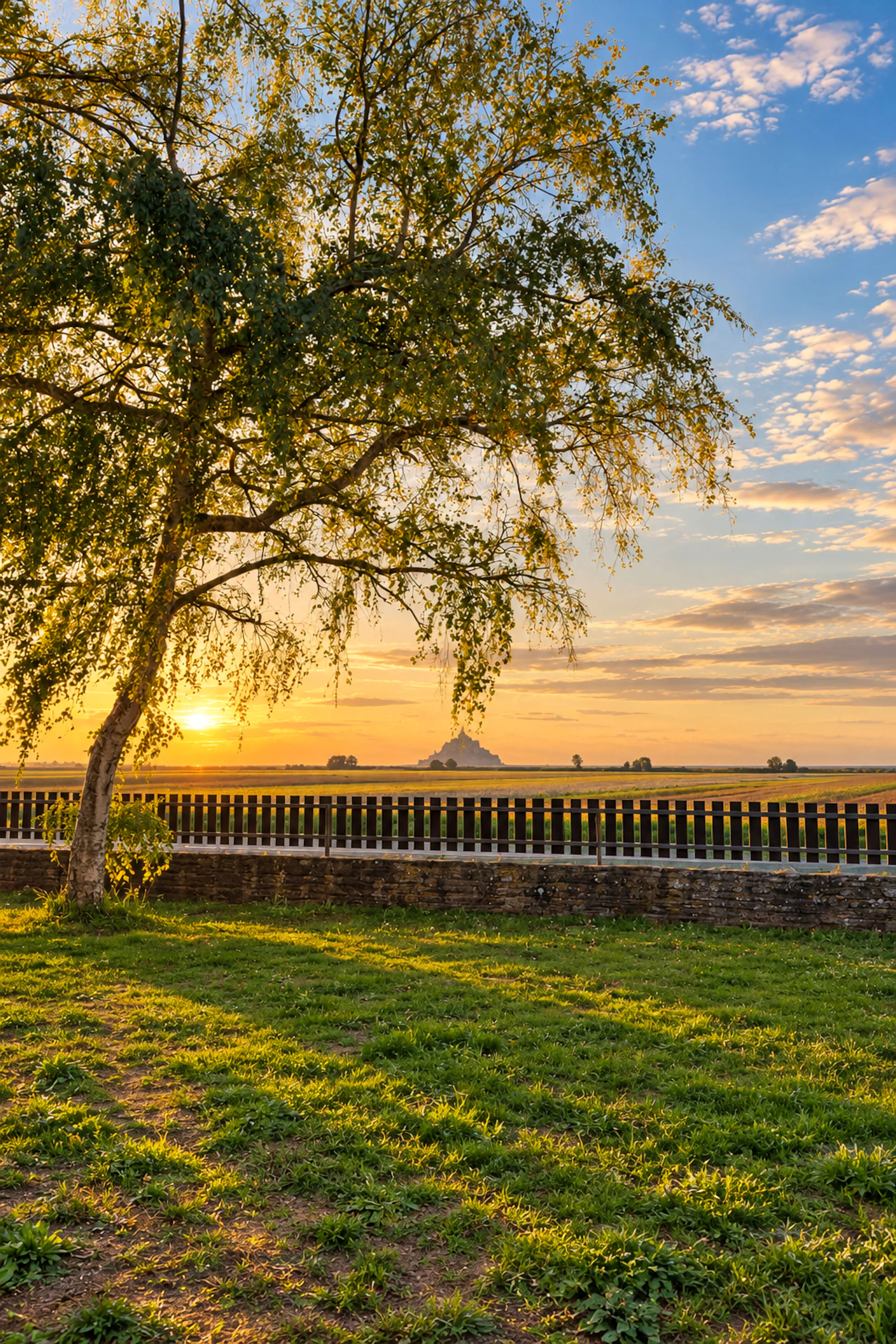
Following the tides from Huisnes-sur-Mer
The house is about 6 km from the Mont, which makes the big tides easy: check the high-water time in the morning, set off at the right moment, and drive back without hunting for a hotel if the wait runs long.
Check-in is from 3 pm and check-out by 11 am, so an evening high tide fits neatly on arrival day.
Information checked on 21 November 2026 on the websites of the Établissement public du Mont-Saint-Michel, the Tourist Office and SHOM, linked in the text. Tide times and heights vary with the weather: the official information for the day is what counts.
The tides 6 km away, the Mont beyond the garden.
Les Prémices du Mont sleeps up to 8 in Huisnes-sur-Mer. For a big tide, being a few minutes from the Mont changes everything: you leave on the sea’s schedule, not the road’s.